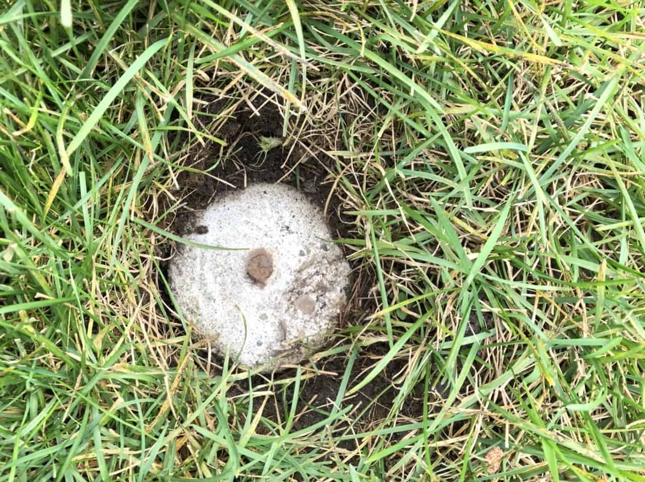
Hidden Survey Markers At Odd State Borders

Have you ever wondered why some state borders have odd shapes or unexpected twists? These quirks often come from hidden survey markers placed long ago. Surveyors used these markers to define boundaries, but over time, natural changes and human activities have obscured them. Some borders follow rivers that have shifted, while others trace old trails or even mistakes in early maps. Understanding these markers can reveal fascinating stories about history, geography, and even politics. Next time you look at a state map, think about the hidden markers that shaped those lines. They hold secrets waiting to be uncovered.
Hidden Survey Markers at Odd State Borders
Ever wondered about the quirky spots where state lines meet? These hidden survey markers often tell fascinating stories about history, geography, and human ingenuity. Let's explore some of the most intriguing ones.
1. Four Corners Monument
The only point in the United States where four states meet: Arizona, Colorado, New Mexico, and Utah. This marker is a popular tourist spot, allowing visitors to stand in four states simultaneously. It's a unique geographical oddity that draws thousands each year.
2. Tri-State Marker
Located where New Jersey, New York, and Pennsylvania converge, this marker sits on the Delaware River. It's a bit tricky to find, nestled in a wooded area, but the adventure is worth it. The marker is a simple stone obelisk, but its significance is monumental.
3. The Northwest Angle
Minnesota's Northwest Angle is the northernmost point in the contiguous United States. The border here is a result of a mapping error from the 18th century. The survey marker is in a remote area, accessible only by crossing into Canada or by boat.
4. The Mason-Dixon Line
This famous line separates Pennsylvania from Maryland, Delaware, and West Virginia. Originally surveyed in the 1760s to resolve a border dispute, the Mason-Dixon Line later became symbolic as the divider between the North and South. The markers are stone mileposts, some of which still stand today.
5. The 45th Parallel
This marker indicates the halfway point between the Equator and the North Pole. Found in several states, including Oregon, New Hampshire, and Wisconsin, these markers are often overlooked but fascinating. They remind us of the Earth's vastness and our place within it.
6. The 100th Meridian
Running from North Dakota to Texas, the 100th Meridian is a significant geographical marker. It traditionally marks the divide between the humid eastern United States and the arid western plains. Survey markers along this line are sparse but historically important.
7. The Georgia-Tennessee Border Dispute
A survey error in the 19th century placed the Georgia-Tennessee border a mile south of where it should be. This mistake has led to ongoing disputes, especially over water rights. The original survey marker is still there, a silent witness to the controversy.
8. The 37th Parallel
Known as the "Baseline," this parallel forms the border between Kansas and Oklahoma. Surveyed in the 1850s, the markers along this line are often simple stones or metal stakes. They mark a critical line in the U.S. Public Land Survey System.
9. The 49th Parallel
This line forms part of the U.S.-Canada border, stretching from Washington to Minnesota. Surveyed in the 19th century, the markers here are more substantial, often stone or iron pillars. They symbolize the peaceful boundary between two nations.
10. The Point of Beginning
Located in East Liverpool, Ohio, this marker signifies the starting point of the U.S. Public Land Survey System. Established in 1785, it marks where the first survey began, shaping the layout of much of the United States. The marker is a simple plaque but holds immense historical value.
The Fascination of Hidden Survey Markers
Hidden survey markers at odd state borders tell stories of history, geography, and human effort. These markers, often overlooked, are crucial in defining boundaries and resolving disputes. They reveal the meticulous work of surveyors who braved tough terrains to place them accurately. Exploring these markers can be a fun and educational adventure, offering a unique way to understand state borders and their quirks. Next time you find yourself near a state line, look for these hidden gems. They might just give you a new appreciation for the invisible lines that shape our world. Whether you're a history buff, geography enthusiast, or just curious, these markers offer a fascinating glimpse into the past. So, keep an eye out and let these hidden survey markers add a new layer of intrigue to your travels.

